


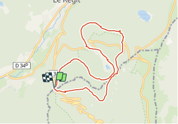
Col du Bramont-Chemin de Vaxélaire - Tourbier de Machais - Chemin du Génie - Abri Col de l'Etang et retour par GR531

patrickbeyrath
User

Length
8.8 km

Max alt
1139 m

Uphill gradient
369 m
Km-Effort
13.8 km

Min alt
965 m

Downhill gradient
370 m
Boucle
Yes
Creation date :
2021-07-02 05:50:08.456
Updated on :
2021-07-02 06:13:12.816
3h20
Difficulty : Medium

FREE GPS app for hiking
 SityTrail
IGN / Geographical institutes
SityTrail Plus
The world is yours!
About
Trail On foot of 8.8 km to be discovered at Grand Est, Vosges, La Bresse. This trail is proposed by patrickbeyrath.
Positioning
Country:
France
Region :
Grand Est
Department/Province :
Vosges
Municipality :
La Bresse
Location:
Unknown
Start:(Dec)
Start:(UTM)
346751 ; 5318408 (32U) N.
Comments